-
 DR
DR
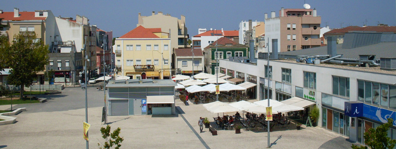
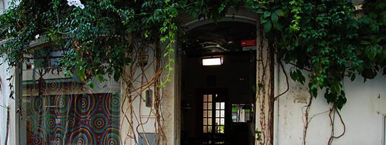
 1º MAIO MARKET SQUARE / CATARINA EUFÉMIA PARK
One of the main highlights of the city center’s 2010 requalification, envisioned by catalonian architect Joan Busquets, this square, where the Catarina Eufémia Park meets the 1º Maio Municipal Market, features cafes and restaurants that spread outdoors, in typical Portuguese fashion. This is also the place to find the city’s tourism office.
GPS: 38.661374,-9.07842
GoogleMaps -
 © Vitor Oliveira
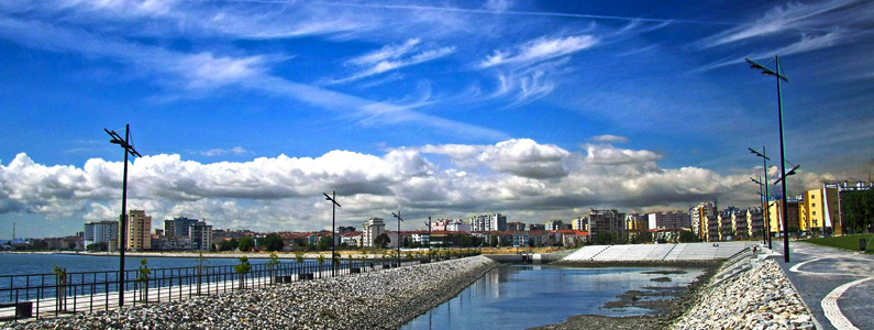
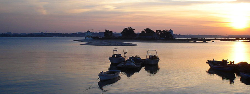
CHRISTELLE-MAR RESTAURANT / POLIS QUINTA DA LOMBA
© Vitor Oliveira
CHRISTELLE-MAR RESTAURANT / POLIS QUINTA DA LOMBA
Part of an urban regeneration program supported by European Funding, the Riverside area of Quinta da Lomba has become one of the most pleasant spots in the city, and now part of the city’s jogging and bike circuits. It’s also one of the best places to enjoy a beautiful sunset by the Tagus.
The nearby restaurant Christelle-Mar is, nowadays, one of the best and freshest seafood spots in the city.
GPS: 38.646548,-9.064548
GoogleMaps -
 DR
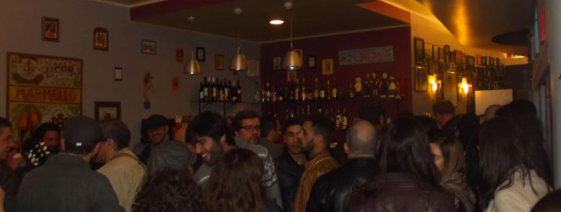
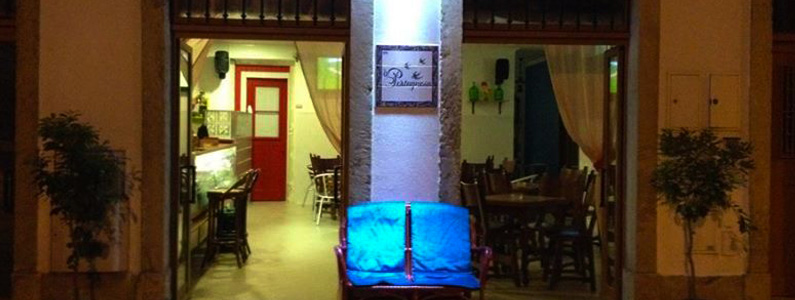
TASCA DA GALEGA
DR
TASCA DA GALEGA
The “Galega” is a historical small restaurant right at the heart of the city, which has been, for the past 2 years, under the management of João Cruz, aka Johny Intense, himself a historical figure in the city’s music scene – he plays and has played guitar in several of Barreiro’s rock scene legendary acts, The Act-Ups being one of the more notable.
Nowadays the Galega is the place you go to for delicious home cooked meals (best fries in town, by the way) in an intimate, warm and welcoming feel provided by the staff and the delicious décor, which ranges from vintage Portuguese ads to a wall full of excellent rock n’roll legends (both local and international) photos.
www.facebook.com/atascadagalega
GPS: 38.660913,-9.077991
GoogleMaps -
 DR
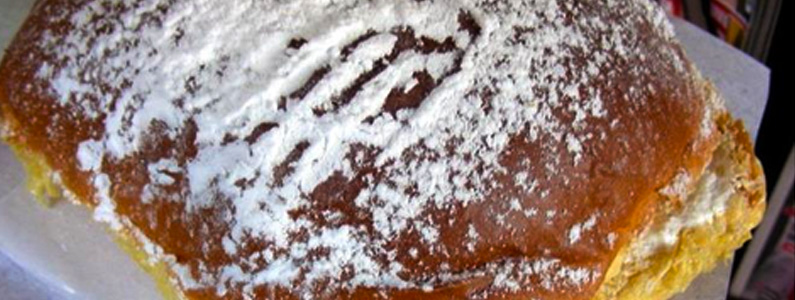
PASTELARIA MODERNA
DR
PASTELARIA MODERNA
Lisbon is justifiably famous for its custard tart, the ‘Pastel de Belém’, but there’s also a pastry specialty in Barreiro: the over-proportioned ‘Bola de Manteiga’ (just google it). There is not a single person who has tried it and didn’t go back for more. Highly recommended!
www.facebook.com/pastelaria.moderna
GPS: 38.658922,-9.067382
GoogleMaps -
 DR
À PORTUGUESA
DR
À PORTUGUESA
A small bar with a privileged location, some 20m from the Tagus River, and a particular characteristic: they only sell Portuguese products. You won’t find a Coke, for instance, but you’ll be able to try some old-time classics such as the ‘Capilé’, together with contemporary favourites like Licor Beirão, Moscatel or Port wine. Another highlight is the original snacks like the ‘Hamburgalheira’, a burger-type creation with one of Portugal’s most beloved smoked sausages, the ‘Alheira’.
www.facebook.com/aPortuguesaBrr
GPS: 38.664536,-9.078151
GoogleMaps -
 DR
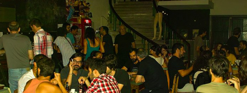
BAR D’OS PENICHEIROS
DR
BAR D’OS PENICHEIROS
Barreiro is known for its strong and ever-present cooperatives and worker associations. There are, literally, dozens of associative spaces all around the city that carry a huge historical importance, and amongst them the centennial ‘Penicheiros’ is one of the most renowned. Its bar is still, nowadays, a place where many of the most relevant cultural events in the city take place, such as concerts, movie screenings, theatre plays or art exhibits, while being, as well, a meeting point at the heart of the city’s nightlife.
www.facebook.com/bardospenicheiros
GPS: 38.663281,-9.079708
GoogleMaps -
 © Vera Marmelo
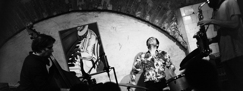
BE JAZZ CAFÉ / BARREIRO JAZZ SCHOOL
© Vera Marmelo
BE JAZZ CAFÉ / BARREIRO JAZZ SCHOOL
Be Jazz Café is a venue that has witnessed some unforgettable OUT.FEST nights. Throughout the year, though, it’s the place where more trad-jazz lovers convene week after week. Regular programming includes jam sessions and concerts by Barreiro Jazz School’s (located in the same building) Big Band.
GPS: 38.66271,-9.07939
GoogleMaps -
 DR
CASA DO HUGO
DR
CASA DO HUGO
One of Barreiro’s best known restaurants, and the first that always comes to mind when you think of fresh fish, grilled to perfection. As a bonus, there’s the possibility of enjoying your meal on a terrace with a great view to the Tagus.
www.facebook.com/casadohugo.barreiro
GPS: 38.662896,-9.083415
GoogleMaps -
 DR
O PIAL
DR
O PIAL
A modern classic, and the informed choice for vegetarians and fans of healthy, homemade food in general. With a truly vintage décor, a supremely relaxed atmosphere and a small terrace in the back where hours just fly by, it’s one of the best spots for a lunch in the city centre.
http://www.facebook.com/pages/O-Pial/211207579056984
GPS: 38.662281,-9.07666
GoogleMaps -
 DR
DR
 ALBURRICA BEACH / WINDMILLS / BARREIRO SURF SCHOOL
Dating back to 1852, the three Alburrica Windmills, built according to the famous windmills model, functioned for almost a hundred years. Being deactivated in 1950, the largest of the three housed fishermen and their families for another fifty years, when, in 1998, the Municipality took hold of them as official public landmarks.
One of the windmills bears a traditional Portuguese tile panel, evoking Nossa Senhora do Rosário, the city’s patron saint.
In the same place we can find the Alburrica beach, which, having always been used by the locals, has seen, in the past few years, and due to a planned intervention and the gradual growth in cleanliness of the Tagus’ waters, a surge that is firmly placing it as one of the best urban beaches in the Lisbon area. The new Barreiro Surf School has also opened recently in one of the windmills, setting a new standard for exploring the surf potential of the waves generated by the Barreiro-Lisbon ferries.
GPS: 38.656862,-9.087229
GoogleMaps -
 DR
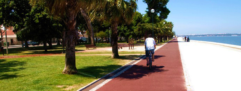
AVENIDA DA PRAIA
DR
AVENIDA DA PRAIA
Literally meaning “Beach Avenue”, the Avenida Bento Gonçalves (its official name) is one of Barreiro’s most cherished secrets, due to its inspiring beauty and light. It’s a true balcony leaning over the Tagus River, with one of the most beautiful views of Lisbon and a place for joggers, fishermen, romantic couples and the occasional dog-sitters.
GPS: 38.663259,-9.082674
GoogleMaps -
 © CMB
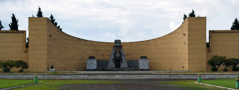
INDUSTRIAL CITY
© CMB
INDUSTRIAL CITY
Throughout most of the 20th century the city and its vast industrial complex were almost inseparable, almost a synonym. Nowadays, the area still holds the key to Barreiro’s past, present and future identity. The territory has been undergoing, for the past decade or so, a slow requalification and revitalization – heavy industry is now almost non-existent, with the 3rd sector more and more present, and its borders are slowly opening up to the city itself. Worthwhile visits include the Workers District, the Industrial Museum, Alfredo da Silva’s (the legendary industrialist) fantastic Mausoleum and the City’s Archaeological Preserves.
GPS: 38.665491,-9.073784
GoogleMaps -
 © Luís Ferreira da Luz
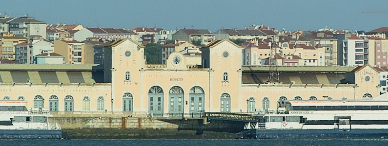
OLD RAILWAY STATION
© Luís Ferreira da Luz
OLD RAILWAY STATION
Designed by Miguel Pais, renowned engineer whose name came to be immortalized in one of the city’s main streets, the old railway and ferry station is still today one of Barreiro’s most beautiful monuments, with its conjugation of romantic, industrial and neo-Manueline traces. Up until the end of the millennium it was the starting and finishing point for the Alentejo and Algarve lines, seeing hundreds of passing-by tourists en route to Portugal’s southernmost region while, at the same time, being used by Barreiro-Lisbon commuters.
Placed at the exact junction between the Tagus and Coina rivers, the station still bears an aura in face of which it’s hard to remain unmoved.
GPS: 38.653272,-9.08048
GoogleMaps -
 DR
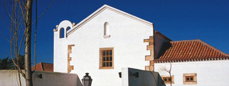
MADRE DE DEUS DA VERDERENA CONVENT
DR
MADRE DE DEUS DA VERDERENA CONVENT
Built in 1609, in accordance with the Franciscan Monks’ typical austere architecture, the Verderena Convent was acquired by the Municipality in 1969, but it was only from 1995 onwards that an effective rehabilitation went underway, dedicating the building to several cultural uses. The old chapel and cloisters have staged unforgettable OUT.FEST concerts in the past, and there’s a rumor, albeit never confirmed, of the existence of a secret tunnel leading directly to the beautiful Arrábida Mountain, in Setúbal.
GPS: 38.654064,-9.062757
GoogleMaps -
 DR
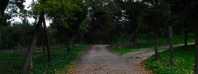
MATA DA MACHADA NATURE PRESERVE
DR
MATA DA MACHADA NATURE PRESERVE
The Machada woods are one of the most important green areas south of the Tagus – a vast terrain where the word biodiversity makes evermore sense. Over there we can find the Municipality’s Environmental Education Centre, which hosts a vast programme of environmentally responsible activities throughout the year, as well as a large archaeological field which attests to the area’s importance in Portuguese history: signs of a pre-industrial role in the 15th century have emerged, with a huge ceramic oven used for the manufacturing of industrial and daily utensils still visible, and of course, there’s also the fact that a huge part of the wood used for the ‘Caravelas’ and ‘Naus’ of the big 15th century adventures, known as the Discoveries, which took Portuguese sailors all over the world, was taken from here. Apart from all its historical and environmental relevance, the Machada Woods are, nowadays, a perfect spot for some of the simple pleasures of life, be it a reinvigorating walk, a picnic, jogging or a casual bike-ride.
GPS: 38.617155,-9.04733
GoogleMaps -
 © Álvaro Morgado
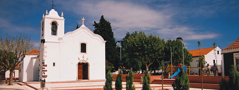
PALHAIS CHURCH
© Álvaro Morgado
PALHAIS CHURCH
Due, in particular, to its Manueline portal, the Palhais Church is classified as National Heritage. It signals an era (the 15th century) when the present Palhais parish was the most populated area in the whole Barreiro Municipality. Its construction had direct ties to the Ordem de Santiago, under direct scrutiny from Vasco da Gama’s brother Paulo da Gama.
GPS: 38.626267,-9.049291
GoogleMaps -
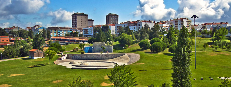 © Vitor Oliveira
CITY PARK
© Vitor Oliveira
CITY PARK
Anyone who grew up in the 80’s, in Barreiro, will remember the abandoned warehouses of the former Granadeiro cork factory, where a seemingly unending stock of classical music vynil records was up for the take. In 2000, and on these same mythical grounds, the City Park was inaugurated, as a place of excellence for sports, leisure, or general dolce-far-niente. It is also the location for the Augusto Cabrita Municipal Auditorium, the city’s noblest concert room and one of OUT.FEST’s venues.
GPS: 38.64907,-9.062102
GoogleMaps
